Skip to content
  • Geomatics
    • FastGBSAR
    • ECR-C
    • MetaSAR
      • MetaSAR-P
  • Defence
    • Guardian
  • Space
    • StarSAR-X
    • PhoeniX
    • Payload Ground Segment
      • Ground SAR Processor
Menu
  • Geomatics
    • FastGBSAR
    • ECR-C
    • MetaSAR
      • MetaSAR-P
  • Defence
    • Guardian
  • Space
    • StarSAR-X
    • PhoeniX
    • Payload Ground Segment
      • Ground SAR Processor
  • News & Blogs
  • Contact
Menu
  • News & Blogs
  • Contact
  • EN
  • IT
Menu
  • EN
  • IT
  • Old Geomatics
    • MetaSAR
    • ECR-C
    • FastGBSAR
  • Old Defence
    • KAISAR
    • FOPEN
    • GUARDIAN
  • Old Space
    • SAR Payload
      • StarSAR-X
      • PhoeniX
    • Payload Ground segment
      • Ground SAR Processor
  • Weather
  • About us
    • Jobs & Careers
    • Investors
    • News & Blogs
  • Contact
Menu
  • Old Geomatics
    • MetaSAR
    • ECR-C
    • FastGBSAR
  • Old Defence
    • KAISAR
    • FOPEN
    • GUARDIAN
  • Old Space
    • SAR Payload
      • StarSAR-X
      • PhoeniX
    • Payload Ground segment
      • Ground SAR Processor
  • Weather
  • About us
    • Jobs & Careers
    • Investors
    • News & Blogs
  • Contact
  • About us
  • Jobs & Careers
  • Investors
  • Contact sales
Menu
  • About us
  • Jobs & Careers
  • Investors
  • Contact sales

Technology you can trust

MetaSAR

MetaSensing offers a range of ground-based and airborne radar sensors for natural and man-made hazard prevention and monitoring. We use top-level radar technology and signal processing to provide risk assessment and early warnings.

MetaSAR

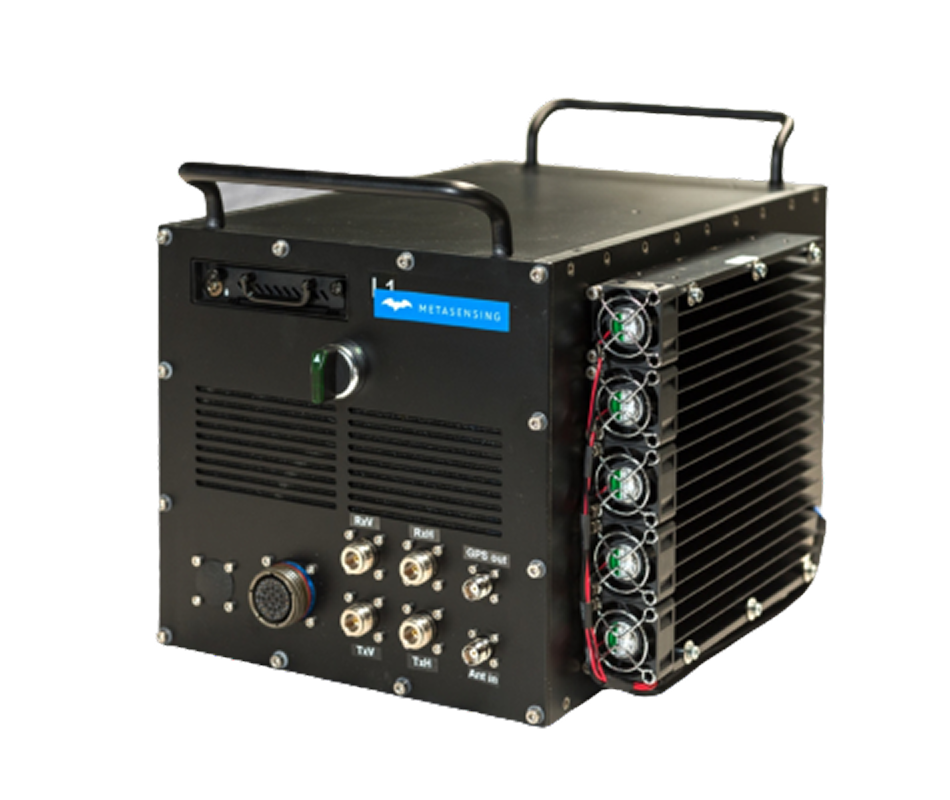
MetaSensing’s MetaSAR is a compact multi-channel multi-frequency SAR (Synthetic Aperture Radar) sensor that can be configured to operate at a wide range of frequencies including P-, L-, C-, X-, Ku-, Ka-bands.

Given its small size and low power consumption, the MetaSAR sensor is particularly suited for small aircrafts or UAVs.

We use many different data acquisition and processing techniques, such as cross-track and along-track interferometry, single-pass and repeat-pass interferometry, full polarimetry.

We can integrate multiple frequency systems and adapt the data acquisition techniques to specific customer needs.

See MetaSAR-P

Downloads & Brochures

  • MetaSAR-P
  • MetaSAR-C
  • MetaSAR-X
  • MetaSAR-L

Products

Airborne SAR

Mapping of land cover, snow and glaciers, classification of vegetation, oceanographic applications and generation of Digital Elevation Models.

DinSAR

Monitoring of terrain movements and of land use.

Italy

Rocca D’Evandro

Italy

Milano

The Netherlands

Leiden

Singapore

Singapore

  • Quality policy
  • Privacy Statement (EU)
  • Cookie Policy (EU)
  • Disclaimer
  • © 2025 by Metasensing. All Rights Reserved.
Manage Cookie Consent
We use cookies to optimize our website and our service.
Functional Always active
The technical storage or access is strictly necessary for the legitimate purpose of enabling the use of a specific service explicitly requested by the subscriber or user, or for the sole purpose of carrying out the transmission of a communication over an electronic communications network.
Preferences
The technical storage or access is necessary for the legitimate purpose of storing preferences that are not requested by the subscriber or user.
Statistics
The technical storage or access that is used exclusively for statistical purposes. The technical storage or access that is used exclusively for anonymous statistical purposes. Without a subpoena, voluntary compliance on the part of your Internet Service Provider, or additional records from a third party, information stored or retrieved for this purpose alone cannot usually be used to identify you.
Marketing
The technical storage or access is required to create user profiles to send advertising, or to track the user on a website or across several websites for similar marketing purposes.
Manage options Manage services Manage vendors Read more about these purposes
Preferences
{title} {title} {title}