Skip to content
  • Geomatics
    • FastGBSAR
    • ECR-C
    • MetaSAR
      • MetaSAR-P
  • Defence
    • Guardian
  • Space
    • StarSAR-X
    • PhoeniX
    • Payload Ground Segment
      • Ground SAR Processor
Menu
  • Geomatics
    • FastGBSAR
    • ECR-C
    • MetaSAR
      • MetaSAR-P
  • Defence
    • Guardian
  • Space
    • StarSAR-X
    • PhoeniX
    • Payload Ground Segment
      • Ground SAR Processor
  • News & Blogs
  • Contact
Menu
  • News & Blogs
  • Contact
  • EN
  • IT
Menu
  • EN
  • IT
  • Old Geomatics
    • MetaSAR
    • ECR-C
    • FastGBSAR
  • Old Defence
    • KAISAR
    • FOPEN
    • GUARDIAN
  • Old Space
    • SAR Payload
      • StarSAR-X
      • PhoeniX
    • Payload Ground segment
      • Ground SAR Processor
  • Weather
  • About us
    • Jobs & Careers
    • Investors
    • News & Blogs
  • Contact
Menu
  • Old Geomatics
    • MetaSAR
    • ECR-C
    • FastGBSAR
  • Old Defence
    • KAISAR
    • FOPEN
    • GUARDIAN
  • Old Space
    • SAR Payload
      • StarSAR-X
      • PhoeniX
    • Payload Ground segment
      • Ground SAR Processor
  • Weather
  • About us
    • Jobs & Careers
    • Investors
    • News & Blogs
  • Contact
  • About us
  • Jobs & Careers
  • Investors
  • Contact sales
Menu
  • About us
  • Jobs & Careers
  • Investors
  • Contact sales

MetaSensing flies to the Arctic

After the successful campaigns of the previous years, once again MetaSensing is participating to the ESA CryoSat calibration Experiment (CryoVEx) aimed to the cross-validation of ESA CryoSat-2 and NASA ICESat-2 altimeter satellite missions.

MetaSensing Ka-band interferometric altimeter

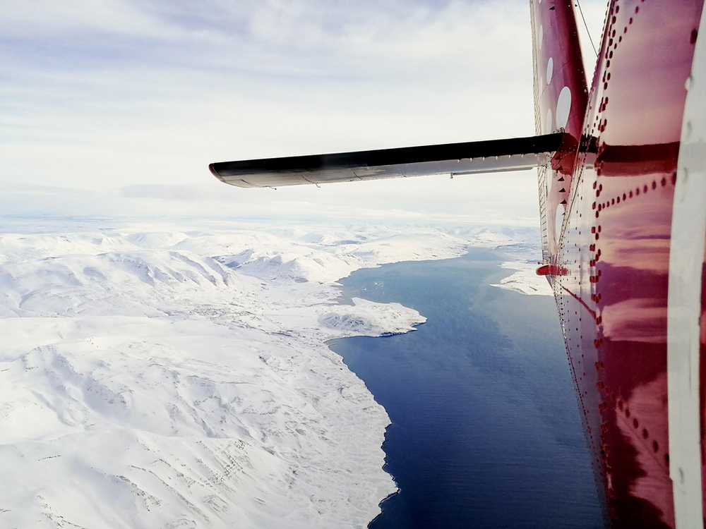
Aerial view of the Akureyri, Iceland after takeoff. The on-board installation has been performed at Norlandair hangar in Akureyri.

The MetaSensing interferometric altimeter at Ka-band (KAREN) is operating on board a Twin Otter aircraft together with other instruments such as the Ku-band radar altimeter and the high-resolution laser scanner. The synergy of these datasets will allow the scientific community to retrieve snow depth estimations.

MetaSensing Ka-band interferometric altimeter

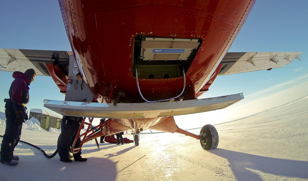
Belly view of the Twin Otter during refueling operations at Station Nord.

CryoVEx consists of an extended campaign in Greenland with acquisition flights over

land and sea ice.

These flights are being performed in coordination with other similar missions as the Alfred Wegener Institute for Polar and Marine Research (AWI) program “IceBird” and the NASA Operation “IceBridge” (OIB): these campaigns provide independent measurements of snow depth.

MetaSensing Ka-band interferometric altimeter

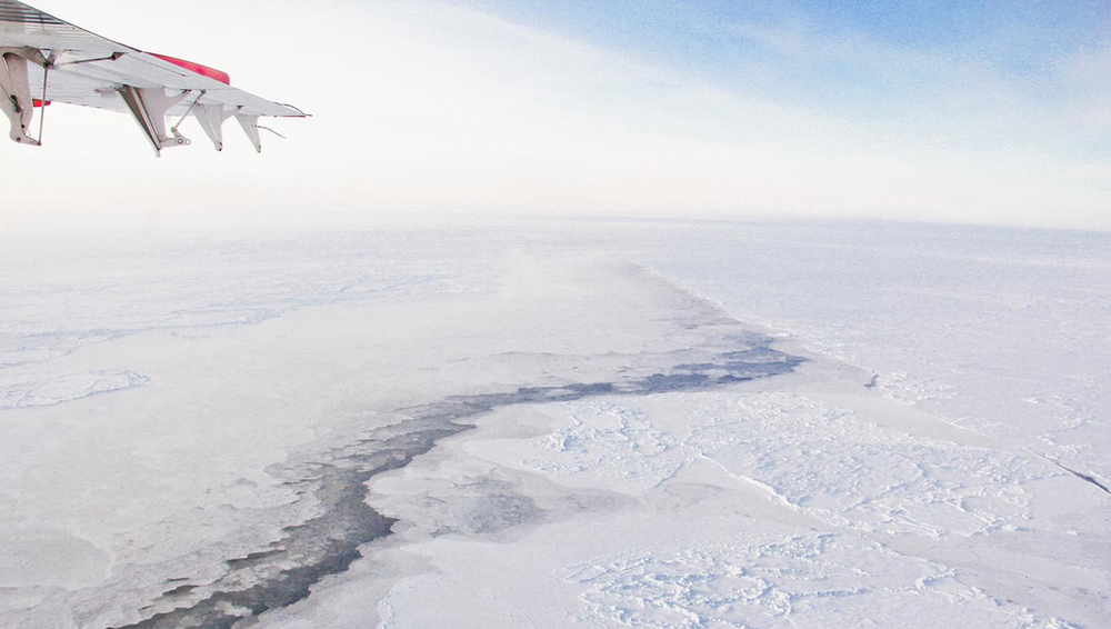
An opening in the sea ice, or lead, caused by the sea currents underneath.

While hosted at the Danish base of Station Nord, flights have been performed over the Arctic Ocean up to and beyond the 85° of latitude North, with the North Pole only few hundreds of kilometers away.

MetaSensing Ka-band interferometric altimeter

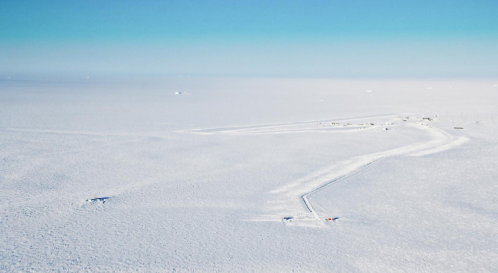
Aerial view of the Station Nord during a pleasant sunny day with temperature of -25°C, ideal for a science flight.

Afterwards, the team moved to the American Air Base of Thule, and down to the town of Ilulissat, while acquiring data over the Baffin Bay. A peculiar character of these latitudes has been encountered during the measurements, luckily from a safe distance.

MetaSensing Ka-band interferometric altimeter

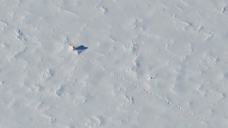
A polar bear was spotted during the flight over the Baffin Bay.

The team is currently grounded in Ilulissat, due to bad weather conditions, and is waiting for a decent weather window that allows a second flight over the ice sheet, before heading back to Iceland and the Netherlands.

Finger crossed for the weather to clear up soon!

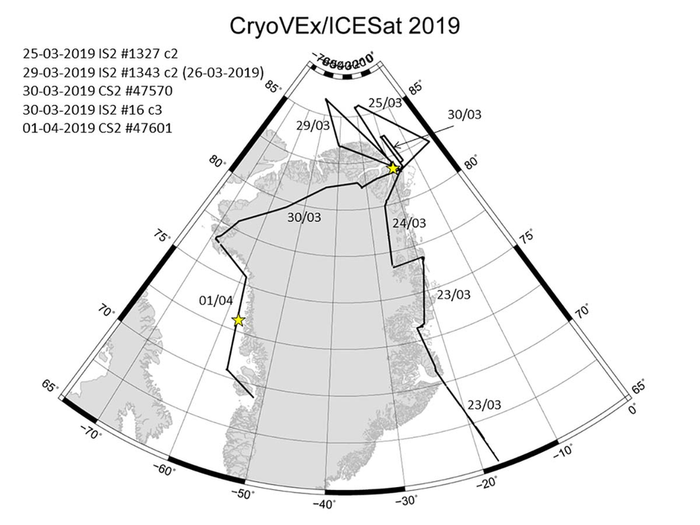
Performed flights for the CryoVEx 2019 – CryoSat/ICESat cross-calibration campaign (Courtesy of DTU).

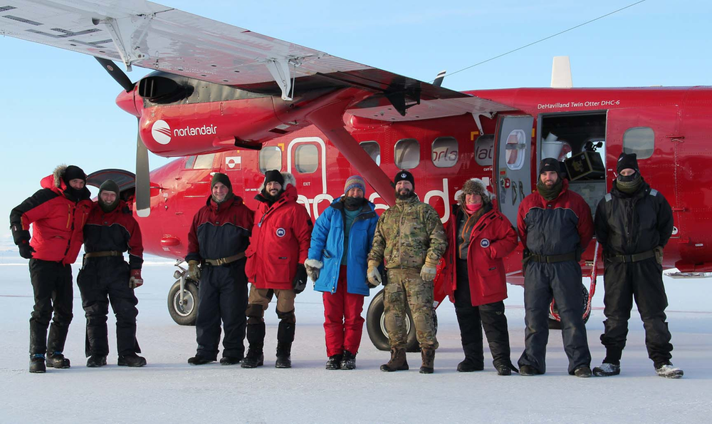
Team picture at Station Nord. From the left: Alex Coccia (Metasensing), Alessandro Di Bella (DTU Space), Tania Casal (ESA) and Henriette Skourup (DTU space) are mixed with the Danish soldiers who kindly hosted the team. A big thank you to them for the warm hospitality.

References:

,https://www.esa.int/Our_Activities/Observing_the_Earth/CryoSat

,http://blogs.esa.int/campaignearth/2018/01/10/cryovex-and-karen-break-for-tea-when-the-weather-is-bad/

,http://blogs.esa.int/campaignearth/2018/01/08/to-antarctica-for-new-space-technology/

,https://www.space.dtu.dk/english

Italy

Rocca D’Evandro

Italy

Milano

The Netherlands

Leiden

Singapore

Singapore

  • Quality policy
  • Privacy Statement (EU)
  • Cookie Policy (EU)
  • Disclaimer
  • © 2025 by Metasensing. All Rights Reserved.
Manage Cookie Consent
We use cookies to optimize our website and our service.
Functional Always active
The technical storage or access is strictly necessary for the legitimate purpose of enabling the use of a specific service explicitly requested by the subscriber or user, or for the sole purpose of carrying out the transmission of a communication over an electronic communications network.
Preferences
The technical storage or access is necessary for the legitimate purpose of storing preferences that are not requested by the subscriber or user.
Statistics
The technical storage or access that is used exclusively for statistical purposes. The technical storage or access that is used exclusively for anonymous statistical purposes. Without a subpoena, voluntary compliance on the part of your Internet Service Provider, or additional records from a third party, information stored or retrieved for this purpose alone cannot usually be used to identify you.
Marketing
The technical storage or access is required to create user profiles to send advertising, or to track the user on a website or across several websites for similar marketing purposes.
Manage options Manage services Manage vendors Read more about these purposes
Preferences
{title} {title} {title}