Technology you can trust
Geomatics
MetaSensing offers a range of ground-based and airborne radar sensors for natural and man-made hazard prevention and monitoring. We use top-level radar technology and signal processing to provide risk assessment and early warnings.
Versatile Radar Technologies: Adapting to
Land, Air, and Space
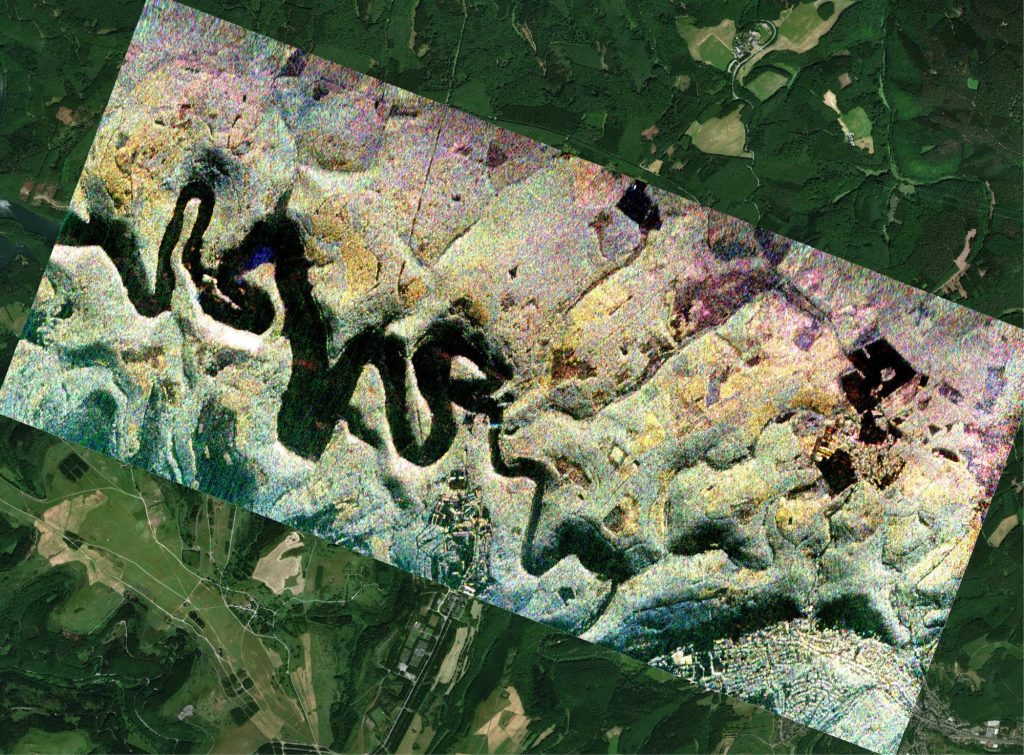
Our radars can be fixed or, when using the SAR (Synthetic Aperture Radar) and Interferometric SAR techniques, they can be installed on a moving platform. Whether the platform is a linear rail on the ground, an aircraft, an UAV or a satellite is up to the user’s need.
By combining different platforms, we can overcome the limitations of single carriers.
Thanks to our flexibility in the choice of the frequency band and of the observation geometry, we can provide innovative solutions for a wide variety of applications, from natural and man-made hazard prevention to aerial mapping.
Geo - product
FastGBSAR
The FastGBSAR is a family of Ku-band ground-based interferometric radars, designed for deformation monitoring in all weather conditions, with four polarimetric channels.
ECR-C
The ECR-C is a compact C-band radar transponder from MetaSensing, designed for accurate satellite radar calibration and supporting precise SAR measurements, suitable for various geomatic applications.
MetaSAR
MetaSAR is a compact, multi-channel SAR sensor suitable for small aircraft and UAVs, offering multi-frequency operation from P to Ka band for versatile data acquisition tailored to specific needs.
Different techniques for different needs.
At MetaSensing we use many different data acquisition and radar processing techniques which allow us to get information about terrain deformations, movements, short or long scale temporal changes in the scene, and to obtain digital surface models.
Ground
Mining
Pit monitoring
Structural monitoring
Dikes, dams, buildings, bridges, airports
Airbone
Land management
Subsidence monitoring, change detection.
Geo - hazards
Landslides, glaciers, avalanches